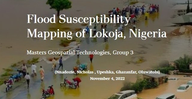
The Flood
Susceptibility Mapping
of Lokoja, Nigeria
A group project by students of the 2022 Erasmus Masters in Geospatial technologies., UJI, Castellon de la plana, Spain.
Posted by: Oluwatobi Ezekiel Adefisan
Student ID: al426468
Introduction
Flooding is a natural disaster that can cause significant damage to property and infrastructure, as well as pose a threat to human life. In recent years, there has been an increasing interest in using geospatial technologies to assess flood susceptibility in urban areas. This blog post presents a flood susceptibility mapping project for Lokoja, Nigeria, which was carried out by a group of students from the Erasmus Masters in Geospatial Technologies program at UJI, Castellon de la Plana, Spain. The project aimed to identify areas in Lokoja that are most susceptible to flooding, using a combination of remote sensing data and GIS analysis.
Background and Challenges
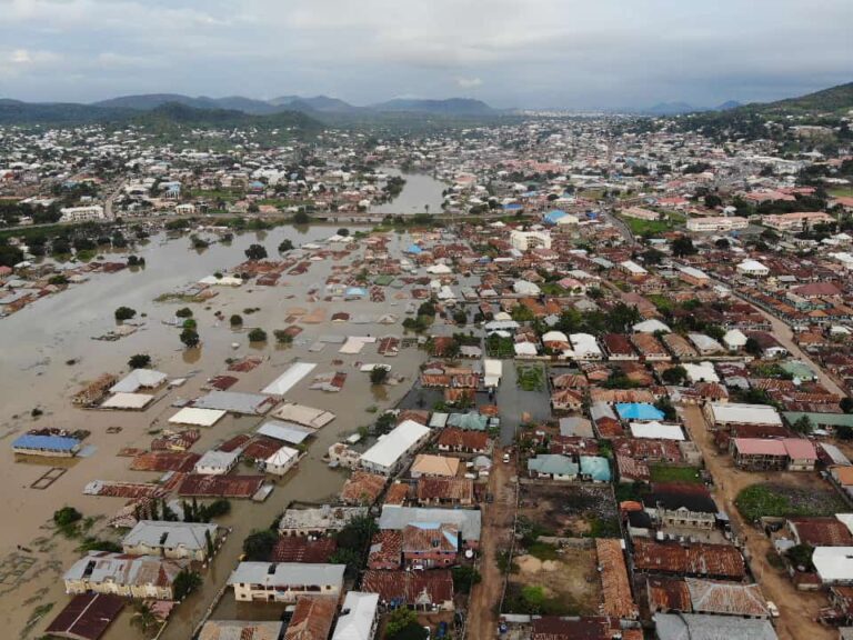
The 12th of June every year is a day in Nigeria marked for celebration of Democracry. But on this very day, 12th of June 2022, Lokoja, the capital city of Kogi State in Nigeria, experienced a very severe flooding due to heavy rainfall. The flood caused significant damage to property and infrastructure, as well as the loss of lives. The flood was exacerbated by the city's topography, which is characterized by low-lying areas and poor drainage systems.
On the 2nd of October 2022, another heavy rainfall occurred in Lokoja, which led to another flooding event. The flood caused significant damage to property and infrastructure, as well as loss of lives. The flood was again exacerbated by the city's topography and poor drainage systems. The two flooding events highlighted the need for this comprehensive flood susceptibility mapping project to identify areas that are most vulnerable to flooding and to develop strategies to mitigate the impact of future floods.
Methodology
The flood susceptibility mapping project for Lokoja was carried out using a combination of remote sensing data, GIS analysis and humanitarian mapping tool. The project team collected data from online sources on various factors that contribute to flood susceptibility, including elevation, slope and precipitation. The collected data from the online sources were then processed and analyzed using GIS software to create a flood susceptibility map for the city. A Flood damage and susceptibility assessment tool was later developed for mapping the extent of the damage. For further details on the data and methodology used, please check the storymap version of the project.
Flood Damage and Susceptibility Assessment Tool
This tool incorporates a community-based survey to assess flood damage and susceptibility. The survey was designed using Survey 123, a mobile data collection app that allows users to collect and submit data in real-time.
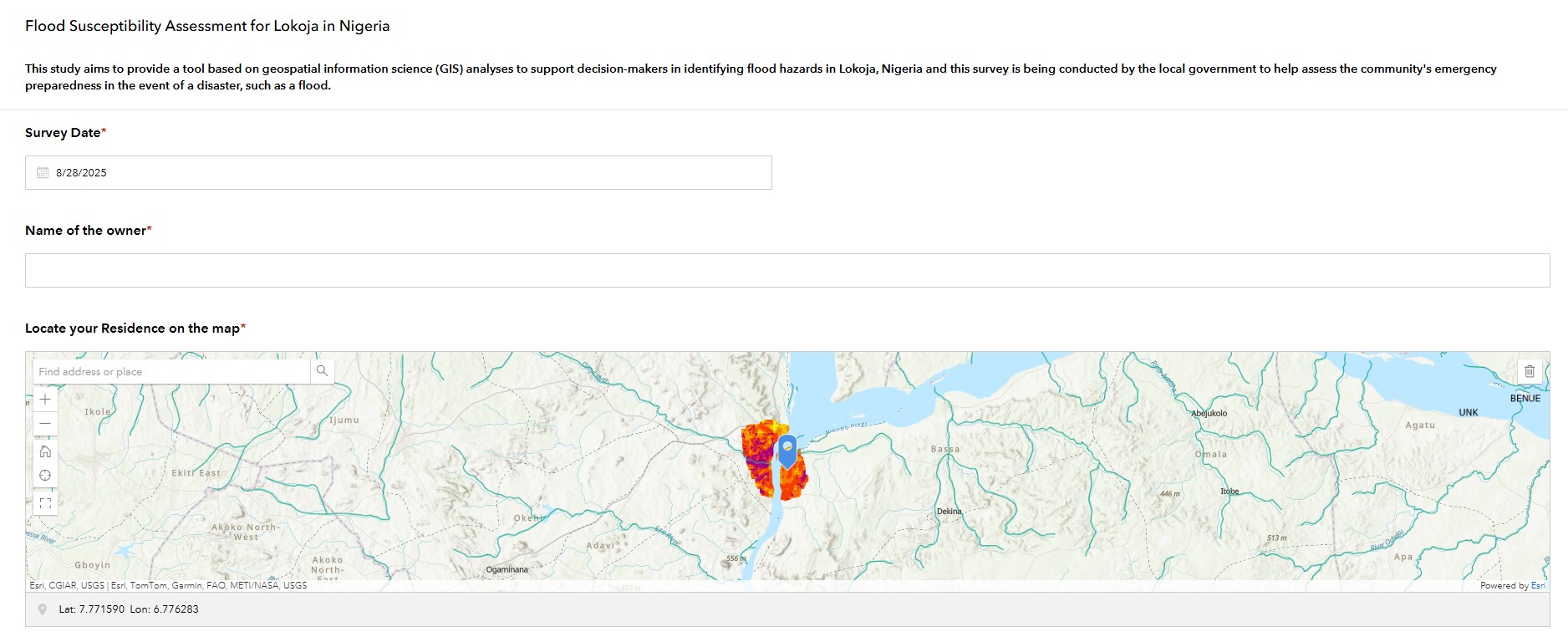
The survey included questions on the extent of flood damage, the causes of flooding, and the measures taken to mitigate the impact of flooding. The survey would be distributed to residents of Lokoja, as well as local government officials and other stakeholders. The data collected from the survey would then be integrated into the GIS analysis to create a more comprehensive flood susceptibility map for the city.
Results and Findings
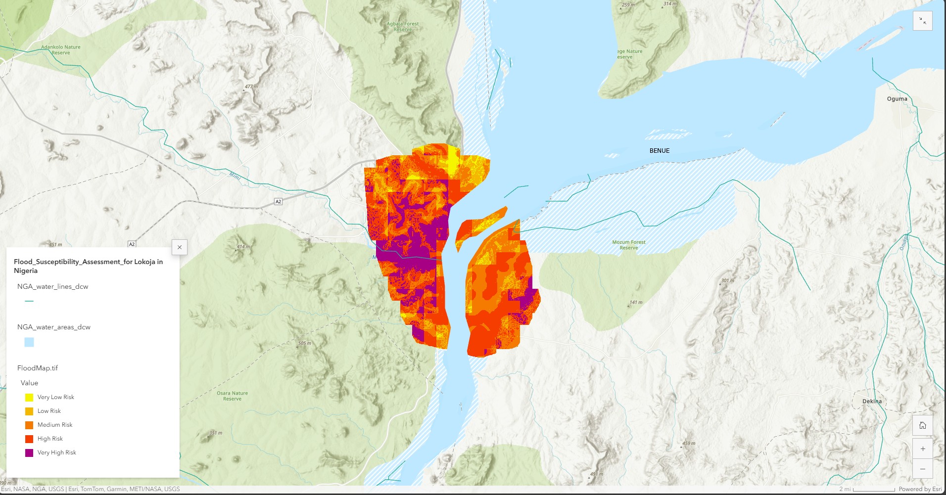
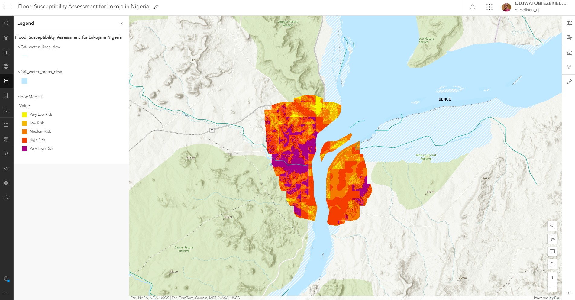
The flood susceptibility map for Lokoja (Figure 3) revealed that the city is highly susceptible to flooding, with large areas classified as high or very high risk. The map was created using a weighted overlay analysis, which involved assigning weights to each factor based on its contribution to flood susceptibility. The final map was classified into five categories, ranging from very low risk to very high risk susceptibility. The map also identified specific areas that are most vulnerable to flooding, including low-lying areas and areas with poor drainage systems. The findings of the project highlight the need for urgent action to address the city's flood vulnerability, including improving drainage systems and implementing flood mitigation strategies.
Conclusion
Overall, the flood susceptibility mapping project for Lokoja demonstrates the potential of geospatial technologies to assess flood vulnerability in urban areas. The project highlights the importance of using a combination of remote sensing data and GIS analysis to create accurate and reliable flood susceptibility maps. The findings of the project can be used to inform flood mitigation strategies and improve the city's resilience to future flooding events. For a complete download of the project and the flood susceptibility map, please click on the download buttons below.